Archaeology, Re-enactment & Reconstruction

Past and present. You can't make this stuff up.
User avatar
Marcus
Posts: 2409
Joined: Tue Dec 27, 2011 2:23 pm
Location: Alaska

The Rebel "Howl" . . .

Post by Marcus »

Torchwood wrote:. . the Rebel Yell . . simply does not sound human - can understand why it would spook the Union troops.
But when all the "yelling" was over . . . ;) . . the Rebel Yell never spooked those Yankee boys enough to prevent them from firing.

Reminds me of what Sherman told Grant . . that if Grant would give him the troops and turn him loose, he, Sherman, would make Georgia howl.
"The jawbone of an ass is just as dangerous a weapon today as in Sampson's time."
--- Richard Nixon
******************
"I consider looseness with words no less of a defect than looseness of the bowels."
—John Calvin
Ibrahim
Posts: 6524
Joined: Tue Dec 20, 2011 2:06 am

Re: Archaeology, Re-enactment & Reconstruction

Post by Ibrahim »

Torchwood wrote:I wondered why both sides made such a fuss about the Rebel Yell - but those recordings explain it. It simply does not sound human - can understand why it would spook the Union troops.
I was very interested to see actual Civil War veterans from Lee's army recreate the "rebel yell" in some early video footage (assuming you believe them, they remembered correctly, etc etc etc) and it basically sounds like the ululating that Greek Hoplites are described as doing prior to clashing, and which Bedouin women did before and after their men leave for/return from raids or battles. There is also a similarity to some Native American war cries.


It's like some universal human war-noise.
User avatar
Antipatros
Posts: 644
Joined: Thu Jan 19, 2012 7:33 pm

Re: Archaeology, Re-enactment & Reconstruction

Post by Antipatros »

Randy Boswell, The War of 1812 explodes on TV

Film explores fiery turning point of the war

http://www.calgaryherald.com/news/1812+ ... story.html
This month's 200th anniversary of the start of the War of 1812 will be marked with a colossal bang: the television premiere of Explosion 1812, a new documentary that argues the intentional detonation of Upper Canada's main ammunition supply at present-day Toronto in April 1813 — described as "one of the biggest explosions that had ever been witnessed in North America" — is a greatly underappreciated moment in history that was key to thwarting the U.S. conquest of Canada.

The two-hour, Canadian-made film — to be aired by History Television on June 17, the eve of the bicentennial of the formal U.S. declaration of war on June 18, 1812 — recounts how retreating British-Canadian troops at Fort York blew up the colony's "grand magazine" along the Lake Ontario shore as American forces closed in on Upper Canada's capital on April 27, 1813.

The storytelling is framed by an archeological search for traces of the explosion, including the enormous crater known to have been left when the military storehouse was blown up, along with its considerable contents: an estimated 14,000 kilograms of black powder, 10,000 cannon balls and 30,000 cartridges.

The field investigation near today's Fort York heritage site, led by Toronto archaeologist Ron Williamson, ultimately yielded several discoveries that shed new light on the events that took place 199 years ago — about a century before the Halifax Explosion of 1917 set a new global standard for catastrophic munition blasts.

Though U.S. forces temporarily seized York, the well-timed destruction of the ammunition depot just west of the pioneer settlement killed or maimed more than 250 American soldiers, deprived the attacking troops of a vital weapons cache that could have ensured the U.S. invasion's long-term success, and covered the eastward escape of a major contingent of Upper Canada's military to Kingston, Ont....
Explosion 1812

http://www.history.ca/ontv/titledetails ... eid=267631
In June 1812, thirty six years after the Declaration of Independence, the United States of America declared war on Britain and invaded its colony of Upper Canada. Across the Atlantic Britain was already locked in a life and death struggle with Napoleon in Europe. Upper Canada was left poorly defended and vulnerable to attack. Britain relied on the support of its native allies and the militia, a part-time army made of local inhabitants most of whom were in fact American. US politicians were convinced they would be welcomed with open arms, and former president Thomas Jefferson declared that victory would be a ‘mere matter of marching’.

As the fate of North America hung in the balance, the odds were stacked heavily in favour of a United States victory. But this isn’t what happened… One year into the war - after a series of bloody encounters on the battlefield - the United States attacked York, the capital of Upper Canada, (modern day Toronto in Ontario). The British defenders of Fort York detonated their Grand Magazine - an armory packed to the rafters with much of the province’s ammunition supply, including nearly 30,000 pounds of gun powder, together with 10,000 cannonballs and 30,000 cartridges...

At the time it was one of the biggest explosions that had ever been witnessed in North America and more than 250 American soldiers were either killed or maimed by the blast. In the days that followed the US army wreaked bitter revenge on the civilian population of York who would come to see the US army not as liberators but as aggressors. And before sailing away, the Americans burned Upper Canada’s first Parliament building and Government House, the command centre of British imperial power.

These events at York, precipitated by the explosion of the Grand Magazine, proved to be a turning point in the War of 1812, after which the conflict degenerated into a bitter cycle of retaliation and retribution. One year later, after the defeat of Napoleon in Europe, thousands of British soldiers were sent across the Atlantic and in revenge for American looting in Canada they marched on Washington DC and burned down the White House.

Although neither side ‘won’ the war and the border between Canada and the United States remained unchanged, after peace was signed on Christmas Eve 1814 the British empire was no longer prepared to risk another war on behalf of its aboriginal allies and the US was able to continue its inexorable expansion westwards through their ancestral lands. North of the border the War of 1812 forged a new sense of identity among the inhabitants most of whom were born in the States but who now for the first time began to see themselves as not American but as distinctly ‘Canadian’.
With any luck, people outside Canada may be able to watch Explosion 1812 on the History Television website.
Be not too curious of Good and Evil;
Seek not to count the future waves of Time;
But be ye satisfied that you have light
Enough to take your step and find your foothold.

--T.S. Eliot
User avatar
Antipatros
Posts: 644
Joined: Thu Jan 19, 2012 7:33 pm

Ft. Walsh, Cypress Hills, Saskatchewan

Post by Antipatros »

Image

Fort Walsh National Historic Site

Map
http://www.pc.gc.ca/lhn-nhs/sk/walsh/index.aspx
This former North West Mounted Police/Royal Canadian Mounted Police post (circa 1878-83) was later used (1942-68) to breed horses for the force and the Musical Ride. Take a guided tour of the fort's buildings, the Fort Walsh townsite, two cemeteries and a reconstructed whiskey trading post. Visitors can also explore the ridge along Battle Creek on self-guided trails and view exhibits in the Visitor Reception Centre.
One of the Mounties buried in the cemetery just up the hill from the reconstructed fort is M.N. Graburn, aged 19 years, "killed by Indians near Fort Walsh" -- the first Mountie killed in the line of duty.

History

http://www.pc.gc.ca/eng/lhn-nhs/sk/wals ... histo.aspx
Established in 1875 Fort Walsh would quickly become the most important, largest and most heavily armed fort the North West Mounted Police garrisoned during their early years in the West. In the heart of the spectacular Cypress Hills, experience life in the 1870s and discover how Fort Walsh presided over one of the most dramatic periods of change on the Prairies. Learn how Canadian law was established in the West, while the Cypress Hills continued to be a meeting place and crossroads for many different peoples, including Mounties, First Nations, Metis, fur traders and whiskey traders. Through diplomacy and conciliation, the North-West Mounted Police avoided much of the violence that often characterised other frontiers. Did you know the internationally recognized image of the RCMP mounted on black horses was born at Fort Walsh? Explore where the RCMP developed their rich traditions at their former headquarters in the Cypress Hills. The story of Fort Walsh is one of fascinating detail and larger-than-life characters. Jerry Potts; Sitting Bull; James Walsh; Big Bear; James Macleod; Alfred Terry; White Bird; Little Pine; Sam Steele; Spotted Eagle; Rain-in-the-Face; Gall; Nelson Miles; Chief Joseph; Lief Crozier; John A. Macdonald; George Armstrong Custer; all these and more are part of the story of Fort Walsh.

Fort Walsh National Historic Site of Canada has been commemorated because the fort served from 1878 to 1882 as the headquarters of the North West Mounted Police; and the fort played a key role: in imposing Canadian law from 1875 to 1883; in implementing Canada's Indian policy; and in supervising the Lakota who fled to Canada under Tantanka Iyotanka (Sitting Bull) after the Battle of the Little Big Horn.

The Cypress Hills Massacre

In a remote corner of the North West Territories, in present-day southwest Saskatchewan, there occurred an event which would have far-reaching consequences for the rest of the country. It would be the subject of many newspaper articles, and controversial court proceedings in both the United States and Canada. It would stir the Dominion government to move quickly to protect Canada's sovereignty in the West.

The North West Mounted Police force was already in the process of being created by John A. Macdonald's government when news of the Cypress Hills Massacre reached Ottawa in mid-August of 1873. The Massacre, which happened on Sunday, June 1, 1873, made it apparent that Canada must do something quickly to police its vast North West Territory. Reports of increasing violence and illegal whiskey-trading had been filtering in for some time, but the government was moving slowly to deal with the problems. Now something had occurred which convinced the government it had better do something sooner rather than later. News of the massacre hastened recruitment and organization of the new police force, and the N.W.M.P. were dispatched to the West the following year. This police force, and its successors, would stamp its mark on the country for many years to come. The colourful image of the "mountie" would impress itself on two nations, and become known around the world.

American adventurers had been trading rot-gut whiskey on Canadian territory since 1869. This whiskey was 100% grain alcohol cut down with water before other ingredients, such as tobacco, red ink, jamaica ginger, and sometimes strychnine, were added. Throughout present-day southern Alberta and southwest Saskatchewan these traders operated without competition or interference. The Hudson's Bay Company, to whose nominal control this territory belonged, seldom ventured into these southern areas, and the bison robe trade was left to the American free-lancers.

The robes were a valuable commodity, for they were used primarily to make belting leather. This was the leather used to make the drive-belts which ran the machinery of the industrialized eastern seaboard of the United States. This mechanization would consume the vast buffalo herds of the North American prairies, just as it would the many whales of the world's oceans. Buffalo leather drive-belts turned the factory machines; whale oil lubricated them. The industrial revolution, also, would cast a long shadow over the U.S. and Canadian west.

In the Cypress Hills of 1873 at least four trading posts were operating. Between them they employed at least thirteen whiskey traders. The scene of the Cypress Hills massacre was near two of them. Moses Solomon operated one whiskey-fort, and a short distance away across the stream which would become known as Battle Creek, the other was owned by Abel Farwell. Both of these men, and most of their hired help, were Americans based out of Fort Benton, Montana; a boomtown and hide depot 150 miles south-southwest of the Cypress Hills....
Image

Image

Image

Image

NCO Barracks

Image

Image

The means of discipline

Image

Forge

Image

Carpenter's shop

Image

Image

South Stables: There were several stables, as befits a cavalry post, including a separate quarantine facility.

Image

Baths: Sheer luxury for the Canadian frontier in the 1870s.

Image

Commissioner's Residence

Image

Fort Walsh grounds
Last edited by Antipatros on Wed Jun 27, 2012 2:28 pm, edited 1 time in total.
Be not too curious of Good and Evil;
Seek not to count the future waves of Time;
But be ye satisfied that you have light
Enough to take your step and find your foothold.

--T.S. Eliot
User avatar
Antipatros
Posts: 644
Joined: Thu Jan 19, 2012 7:33 pm

Fort Walsh -- cont.

Post by Antipatros »

Fort Walsh Historic Trades Day
4JX8-wWgLxA

Fort Walsh National Historic Site - Saskatchewan, Canada
ZuxdmAv2D04
Be not too curious of Good and Evil;
Seek not to count the future waves of Time;
But be ye satisfied that you have light
Enough to take your step and find your foothold.

--T.S. Eliot
User avatar
Antipatros
Posts: 644
Joined: Thu Jan 19, 2012 7:33 pm

Re: Archaeology, Re-enactment & Reconstruction

Post by Antipatros »

Video Tour of the Site
kCP9qSQtbX8

Interactive Dig Crete: Zominthos Project

http://www.archaeology.org/interactive/zominthos/
The ancient Minoans are best known as seafarers, but excavations at the site of Zominthos, nestled in a plateau on Mt. Ida, Crete’s highest mountain, have shown that they were also highlanders. This important second-millennium B.C. site, located about 1,200 meters (nearly 4,000 feet) above sea level, lies on the ancient route between the palace at Knossos, the Minoans’ primary administrative center, and the sacred Ideon Cave, where many believe the legendary god Zeus was born and raised. Zominthos is the only mountaintop Minoan settlement ever to have been excavated and after just a handful of large-scale dig seasons is already yielding groundbreaking information....
Last edited by Antipatros on Wed Jul 25, 2012 3:14 pm, edited 1 time in total.
Be not too curious of Good and Evil;
Seek not to count the future waves of Time;
But be ye satisfied that you have light
Enough to take your step and find your foothold.

--T.S. Eliot
User avatar
Antipatros
Posts: 644
Joined: Thu Jan 19, 2012 7:33 pm

Re: Archaeology, Re-enactment & Reconstruction

Post by Antipatros »

Julian Smith, Tomb of the Chantress

A newly discovered burial chamber in the Valley of the Kings provides a rare glimpse into the life of an ancient Egyptian singer

http://www.archaeology.org/1207/feature ... offin.html
On January 25, 2011, tens of thousands of protestors flooded Cairo’s Tahrir Square, demanding the end of President Hosni Mubarak’s regime. As the “day of revolt” filled the streets of Cairo and other cities with tear gas and flying stones, a team of archaeologists led by Susanne Bickel of the University of Basel in Switzerland was about to make one of the most significant discoveries in the Valley of the Kings in almost a century.

The valley lies on the west bank of the Nile, opposite what was once Egypt’s spiritual center—the city of Thebes, now known as Luxor. The valley was the final resting place of the pharaohs and aristocracy beginning in the New Kingdom period (1539–1069 B.C.), when Egyptian wealth and power were at a high point. Dozens of tombs were cut into the valley’s walls, but most of them were eventually looted. It was in this place that the Basel team came across what they initially believed to be an unremarkable find....
Be not too curious of Good and Evil;
Seek not to count the future waves of Time;
But be ye satisfied that you have light
Enough to take your step and find your foothold.

--T.S. Eliot
User avatar
Antipatros
Posts: 644
Joined: Thu Jan 19, 2012 7:33 pm

Re: Archaeology, Re-enactment & Reconstruction

Post by Antipatros »

Nadia Durrani, London 2012

Archaeology and the Olympics

http://www.archaeology.org/1207/feature ... _park.html
Summer 2012, and the world’s greatest athletes are gathering in London for the Olympics. In advance of the Games, a square mile of semiderelict land in East London’s Lower Lea Valley has been turned into a fully equipped Olympic Park. This has transformed a run-down industrial district into a leafy urban park containing modern amenities including an athletes’ village, basketball arena, and the Olympic stadium. British law decrees that archaeological assessments must be undertaken before such developments, so between 2007 and 2009, the Olympic Delivery Authority (ODA) archaeologists set to work, digging into London’s past.

They excavated no fewer than 121 trenches, recovered more than 10,000 artifacts, and revealed evidence of at least 6,000 years of human activity—from the area’s first prehistoric hunters and farmers to World War II defense structures. In addition, they recorded all of the site’s still-standing historic buildings. Alongside this work, thousands of boreholes were sunk deep into the earth, revealing an environmental and geoarchaeological picture of the area over the past 12,000 years....
Be not too curious of Good and Evil;
Seek not to count the future waves of Time;
But be ye satisfied that you have light
Enough to take your step and find your foothold.

--T.S. Eliot
User avatar
Antipatros
Posts: 644
Joined: Thu Jan 19, 2012 7:33 pm

Montaillou

Post by Antipatros »

I am doing my annual rereading of Emmanuel Le Roy Ladurie, Montaillou. Although he titled the second part of the work "An archaeology of Montaillou: from body language to myth," it is in fact based on a detailed analysis of the Inquisition interrogations of the villagers:

Secret Files of the Inquisition: Root Out Heretics

http://archive.org/details/Humanhistory ... eretics686

Despite their detailed depositions, Ladurie was left with many questions which begged for archaeological excavations. For example, the villagers' statements describe the kitchen (foganha) as a "house within the house," a stone structure surrounded by rather ramshackle wooden rooms. Some houses had cellars or half-buried workshops, but only three houses in the village are known to have had an upper storey (solier). But how large were the houses? How were the areas for the livestock arranged? Were there chimneys, or was smoke from the kitchen fire simply discharged through a hole in the roof, as in antiquity?

So I am pleased to hear that extensive archaeological digs are underway at Montaillou, even if they are not yet accessible to the public.

And beautiful scenery and historical curiosity continue to sustain the old Cathar sites:

Tony Perrotet, The Besieged and the Beautiful in Languedoc

http://www.nytimes.com/2010/05/09/trave ... wanted=all
Eight hundred years ago, these castles in Languedoc, a region of vineyards and olive groves that stretches from the Mediterranean to the Pyrenees in the southwest corner of France, were hideouts of the Cathars, a zealous religious sect that denounced many basic tenets of the Catholic Church. Pope Innocent III was alarmed by the Cathars’ growing popularity, so in 1208 he declared a crusade to eradicate them.

Waves of cross-bearing warriors from northern France and Germany obeyed the holy call, laying siege to Cathar strongholds, slaughtering the heretics and pillaging their lands with a savagery that was startling even by the standards of the Middle Ages. In Béziers, at the northern edge of resistance, over 15,000 men, women and children — the entire population of the town as well as hordes of hapless refugees — were butchered. (The crusader monk Armond Amaury famously told his troops, when asked whom to spare, “Kill them all, God will know his own.”)

Here at the isolated Lastours castles, which were built along a defensive cliff spur, the Cathars spent much of 1209 heroically fending off the onslaught. So the crusader leader, the sadistic Simon de Montfort, resorted to primitive psychological warfare. He ordered his troops to gouge out the eyes of 100 luckless prisoners, cut off their noses and lips, then send them back to the towers led by a prisoner with one remaining eye.

This macabre parade only hardened the Cathars’ resistance, and they lasted until 1211 before capitulating. One by one, the other Cathar towns and strongholds fell to the sword. By 1229 the heresy was largely crushed, and the semi-independent counties of Languedoc, which had harbored it, had succumbed to French rule.

Dramatic stuff, you might say, but it’s hard to visualize these grisly images when surrounded by such seductive mountain scenery. How could this frenzied cruelty have occurred under the same pearly blue sky where the breeze brings the perfume of wildflowers? The main Cathar sites of Languedoc are now part of the 10,570-square-mile modern French region of Languedoc-Roussillon, whose spectacular gorges, rivers, forests and thermal springs make it today one of the country’s most popular summer destinations — a place where Parisians can be found hiking, swimming and savoring the excellent wine. In fact, on a sunny day, it comes as no surprise to learn that, at the same time as the crusade, Languedoc’s many troubadours were creating some of the most enduring love poetry of the Middle Ages....

Today, you could never accuse the good people of Languedoc of hiding their heretic heritage. “You are in Cathar Country” proudly blares a sign on the busy highway from Avignon, followed by concrete statues of Cathar knights.

The romantic castles, superbly positioned on mountain peaks that can now be reached by car, have almost all been lovingly salvaged and adorned with lavish visitor centers, daily re-enactments of medieval life and light-and-sound shows. There is a roughly 150-mile hiking trail that links the key sites, called the Cathar Way, and another following the routes that fleeing heretics took through the backcountry....

Despite crusader victories, the Cathar heresy lingered subversively for about a century, eluding the most ruthless efforts of the Inquisition. The last bastion of the heresy was a village called Montaillou, hidden in the mountains south of Montségur, which has earned outsized fame among history lovers. In 1308, the Inquisition’s officers arrested all 250 adults in the village, beginning a grueling series of investigations that would force the villagers to confess their most intimate secrets. The original Inquisition documents were discovered centuries later in the Vatican archives, and have proved to be a unique trove of information about everyday life in the Middle Ages.

Emmanuel Le Roy Ladurie used the material in his groundbreaking work of social history, “Montaillou,” first published in 1975. The fascinating medieval soap opera, filled with lecherous priests, adulterous chatelaines and conniving peasants, became an international bestseller, adding a colorful new dimension to our pale vision of the medieval world.

Montaillou would be my final stop. But while the outpost looms large on the historian’s world map, I had a hard time finding it near the remote border with Spain and Andorra. Finally, driving through rolling green pastureland, I spied the village near the Ariège River, crowned by an exquisitely decrepit tower of honey-colored stone. As I got out of the car, the only sound was the tinkling of water from a trough.

Somnolent it may be, but Montaillou has come back from the brink of nonexistence. Twenty years ago, it had only 10 permanent inhabitants; today it has 37, and a summer population nearly 10 times that. The Cathars have actually saved the village. “In the early 1990s, Montaillou was virtually a ghost town,” said the mayor, Jean Clergue, who was born here and is an descendant of the same Clergues clan that dominated the area in the Middle Ages.

“But because of Le Roy Ladurie’s book, everyone in France came to hear of it,” he continued. “So when I moved back here in 1992, I met some friends and we said, ’We have to do something or this village is going to disappear!’ ” Mr. Clergue and several others first formed a group called Castellet to salvage the crumbling castle, promote archaeological excavations and hold historical festivals. Today, there is a store selling handicrafts, houses for summer guests and a small restaurant that opens in summer. There is even a radio station, Radio Montaillou.

Its castle may not be as imposing as others, but Montaillou is a strangely affecting place, perhaps because it is still alive; you could almost imagine that the few remaining villagers were the last of the Cathars. I strolled through the site of the original medieval village and followed an ancient trail to a lookout called the Col de Balagues. I was suddenly on the roof of Europe, gazing out at a jagged line of the Pyrenees to the south....
Last edited by Antipatros on Tue Oct 23, 2012 3:51 pm, edited 1 time in total.
Be not too curious of Good and Evil;
Seek not to count the future waves of Time;
But be ye satisfied that you have light
Enough to take your step and find your foothold.

--T.S. Eliot
User avatar
Antipatros
Posts: 644
Joined: Thu Jan 19, 2012 7:33 pm

Re: Archaeology, Re-enactment & Reconstruction

Post by Antipatros »

Grace Murano, 7 Most Fascinating Underwater Ruins

http://www.oddee.com/item_96695.aspx
1 Cleopatra's Palace in Alexandria (Egypt)...

2 World's Wickedest City, Port Royal (Jamaica)...

3 The submerged temples of Mahabalipuram (India)...

4 8000-year-old Yonaguni-Jima (Japan)...

5 Pavlopetri (Greece)...

6 Dwarka Port (India)...

7 The Lost Villages (Canada)...
I'm partial to number 2 on the list.
Be not too curious of Good and Evil;
Seek not to count the future waves of Time;
But be ye satisfied that you have light
Enough to take your step and find your foothold.

--T.S. Eliot
User avatar
Antipatros
Posts: 644
Joined: Thu Jan 19, 2012 7:33 pm

Re: Archaeology, Re-enactment & Reconstruction

Post by Antipatros »

Jamaica - Pirate Sin City : Documentary
850J9tYPd28

National Geographic - Underwater Pirate Tavern
tY1o7GIQdjc

The Port Royal Project

Principal Investigator: Dr. Donny L. Hamilton

http://nautarch.tamu.edu/portroyal/
Once known as the 'Wickedest City on Earth,' Port Royal on the island of Jamaica was one of the largest towns in the English colonies during the late 17th century. It was a haven for privateers and pirates, such as the famed Sir Henry Morgan, due to its excellent geographic location in the middle of the Caribbean. From Port Royal, these buccaneers preyed upon and plundered the heavily laden treasure fleets departing from the Spanish Main.

After 1670, the importance of Port Royal and Jamaica to England was increasingly due to trade in slaves, sugar, and raw materials. It soon became the mercantile center of the Caribbean area, with vast amounts of goods flowing in and out of the port through an expansive trade network.

Unfortunately, the glory of Port Royal was short-lived. On the morning of June 7th, 1692, a massive earthquake hit Jamaica. The tremors rocked the sandy peninsula on which the town was built, causing buildings to slide and disappear beneath the sea. An estimated 2000 Port Royalists were killed immediately in the disaster. Many more perished from injuries and disease in the following days.

From 1981 to 1990, the Institute of Nautical Archaeology, in cooperation with the Nautical Archaeology Program at Texas A&M University and the Jamaica National Heritage Trust, began underwater archaeological investigations of the submerged portion of Port Royal. The following pages highlight what we have found so far. The last excavation season was in 1990 and no further excavations are planned....
Archaeological Excavations

http://nautarch.tamu.edu/portroyal/archhist.htm
In 1981, the Nautical Archaeology Program of Texas A&M University, in cooperation with the Institute of Nautical Archaeology (INA) and the Jamaica National Heritage Trust (JNHT), began underwater archaeological investigations of the submerged portion of the 17th-century town of Port Royal, Jamaica. Present evidence indicates that while the areas of Port Royal that lay along the edge of the harbor slid and jumbled as they sank, destroying most of the archaeological context, the area investigated by TAMU / INA, located some distance from the harbor, sank vertically, with minimal horizontal disturbance.

In contrast to many archaeological sites, the investigation of Port Royal yielded much more than simply trash and discarded items. An unusually large amount of perishable, organic artifacts were recovered, preserved in the oxygen-depleted underwater environment.

Together with the vast treasury of complimentary historical documents, the underwater excavations of Port Royal have allowed for a detailed reconstruction of everyday life in an English colonial port city of the late 17th century.

The Port Royal Project concentrated for 10 years on the submerged 17th-century remains on Lime Street, near its intersection with Queen and High Streets in the commercial center of the town. At present, eight buildings have been investigated. The work has resulted in a more detailed body of data on the buildings and their in situ artifacts than any previous excavations at Port Royal - on land or on under water.

The construction features of five of the investigated buildings exemplify the variety of architectural styles found in the city's center. Some were well-built, multi-storied brick structures, while others were simple, earth-bound frame buildings, hastily erected, with no intention for them to last. In several instances, a small core building was constructed, and then rooms were tacked on as needed, until the structure formed a complex. Both brick and timber buildings have contributed significantly to our understanding of 17th-century town planning, architecture, diet, cooking activities, and other aspects of daily life....
Be not too curious of Good and Evil;
Seek not to count the future waves of Time;
But be ye satisfied that you have light
Enough to take your step and find your foothold.

--T.S. Eliot
User avatar
Antipatros
Posts: 644
Joined: Thu Jan 19, 2012 7:33 pm

Re: Archaeology, Re-enactment & Reconstruction

Post by Antipatros »

Samir S. Patel, Final Resting Place of an Outlaw

Archaeological and forensic detective work lead to the remains of Ned Kelly, one of Australia’s most celebrated, reviled, and polarizing historical figures

http://www.archaeology.org/1209/feature ... _gaol.html
In the photo taken the day before he was hanged in November 1880, Ned Kelly’s eyes are fixed in a firm, defiant gaze. Though much of his face is hidden beneath a thick beard, it is possible that a little smile plays about his lips. But it’s hard to tell for sure.

Kelly is one of the most iconic and polarizing figures in Australian history. He is the most famed of the guerilla bandits known as bushrangers, some of whom, in their day, personified revolt against the colony’s convict system (“Australia’s Shackled Pioneers,” July/ August 2011) and against the excesses of wealth and authority. There’s no real non-Australian analogue for Kelly—he was part Clyde Barrow, part Jesse James, part Robin Hood, but with media savvy and a strong political sense. To some, particularly Australians of Irish descent, he’s a populist hero. To many others, he’s a cop-killer, and his lionization is distasteful at best. He is, at the very least, an enduring subject of fascination.

For all that is known about his life and the crime spree that ensured his immortality, theories have long abounded about what happened to Kelly’s remains after his execution. “Whilst he was an outlaw, there’s a lot of interest in how he was treated by the police, the courts, and judicial systems,” says David Ranson, a pathologist at the Victorian Institute of Forensic Medicine. In the place of certainty, there was rumor, supposition, and endless questions. Had his skeleton been taken apart by trophy hunters? Was his skull put on display and then stolen in the 1970s? Had doctors conducted a clandestine autopsy and taken his remains away for study? It has taken a decade of archaeological, forensic, and historical sleuthing to understand the convoluted story of Kelly’s remains—and those of more than 40 other executed criminals—and learn that everything we thought we knew about that history was wrong. Finally, many of the mysteries surrounding Kelly’s bones can be laid to rest. But not all of them....
Be not too curious of Good and Evil;
Seek not to count the future waves of Time;
But be ye satisfied that you have light
Enough to take your step and find your foothold.

--T.S. Eliot
User avatar
Antipatros
Posts: 644
Joined: Thu Jan 19, 2012 7:33 pm

Re: Archaeology, Re-enactment & Reconstruction

Post by Antipatros »

Image

Image

The Nonsuch

http://www.manitobamuseum.ca/main/wp-co ... ebsite.pdf
The original Nonsuch

In June of 1668, a 53-foot ketch called the Nonsuch weighed anchor and set sail from Gravesend, England. She was off on a trans-Atlantic voyage bound for Hudson Bay.

Her mission was to prove a fur-trade theory, promoted by Radisson and Groseilleurs, that the North American fur trade would be more efficient and expeditious via Hudson Bay rather than the complicated, but established, St. Lawrence River route.

On September 29th, 118 days later, the wooden square-rigger arrived at the southern tip of James Bay. She anchored off the mouth of a river that the crew christened Rupert after Prince Rupert, one of the eighteen backers of the voyage and a cousin of King Charles II.

The following spring, after somehow surviving a typically inhospitable winter with only rudimentary protection from the elements, the crew began a brisk trade in furs with the Cree of the area. That October, its cargo bulging with prime beaver pelts, the Nonsuch was back in England. The furs sold quickly as there was a strong demand for them for manufacture into fashionable beaver felt hats. So encouraged by the outcomes of the voyage, and motivated by the potentially lucrative future prospects, the group of investors approached King Charles for a charter to establish a trading company. His Majesty duly granted their request on May 2, 1670 and the Hudson’s Bay Company was born.

The replica Nonsuch

To celebrate its 300th anniversary in 1970, the Hudson’s Bay Company commissioned the construction of a replica of the ship whose 1668 voyage led to its founding and the opening of the Canadian West to commerce. She would also serve as the company’s gift to the Province of Manitoba, in recognition of its 100th anniversary, where she would make her final home in the Manitoba Museum in Winnipeg.

The replica was built in 1968 in Appledore, Devon, England by J. Hinks and Son. Together with marine architects, woodcarvers and sail makers, Hinks created a modern replica as authentic to the original as possible, thereby realizing the specifications demanded by the Company.

After a festive launch and a dramatic maiden voyage that saw her weather a fierce, North Atlantic gale, the Nonsuch spent the summer of 1969 visiting London, ports along the English Channel coast, and Cherbourg, France. She was under the command of Adrian Small, of Brixham, England, a seasoned sailor who was at her helm throughout her life as a sailing ship.

She arrived in Canada as deck cargo aboard the S.S. Bristol City in March of 1970. After being offloaded in Montreal and refitted in Sorel, Quebec, the replica spent the summer of 1970 visiting ports along the St. Lawrence River and the north shore of Lake Ontario.

The following summer she sailed the entire Great Lakes, from Toronto in the east to Duluth, Minnesota in the west. Wherever she went, she proved to be a popular attraction.

As construction of her museum home had been delayed, the Company decided to continue operating the Nonsuch for a third and final season, this time in British Columbia. To get her from the middle of the country to the West Coast involved an overland journey of epic proportions. The handsome hull of the ship was stripped of everything that could be removed, bolted to sets of wheels, and then hauled by truck from Superior, Wisconsin to Seattle, Washington following a zigzag route of U.S. and Canadian highways, freeways, main drags, residential streets, and back lanes. The trip took six weeks. The rest of the ship – the masts, spars, rigging and other equipment – was shipped separately.

The Nonsuch spent the summer of 1972 sailing from Tacoma, Washington in the south to Kitimat, B.C., its most northerly port of call. She opened Seattle’s sailing season. She circumnavigated Vancouver Island. She attracted huge crowds to Victoria’s Inner Harbour across from the stately Empress Hotel. It was the best of her three summer seasons and there was genuine sadness, by all involved, when it came to an end – an end that was really the beginning of the final phase of her remarkable life....
More history of the original Nonsuch here.

360 degree view of the replica Nonsuch in its gallery:
https://www.mbmuseumfundraising.com/wp/nonsuch/

Alan Hinks

Boatbuilder who made replicas of Viking longboats, Roman galleys and historic sailing ships, including Drake's Golden Hinde

http://www.telegraph.co.uk/news/obituar ... Hinks.html
22 July 2008

Alan Hinks, who has died aged 80, ran the shipbuilding firm J Hinks & Co of Appledore, Devon, which built replicas of historic ships using traditional techniques.

When first asked in the mid-1960s to work on a full-scale model of the ketch Nonsuch, which had sailed from Gravesend for Hudson's Bay in 1668, Hinks had a lifelong enthusiasm but no experience of building ships with square-rigged masts, ornate woodwork and crows' nests.

However he and his wife Audrey took it as a good omen when their black cat Trouvé came and sat on their plans as they studied them on the floor of their sitting room. There was an initial problem in that, at 54ft without the bowsprit, the new Nonsuch was too long to be built at the firm's cramped premises, and planning permission had to be obtained to fit out a bigger yard on the site of Appledore's old gasworks.

For the next 11 months some 33 workers, including apprentices and older hands brought out of retirement, employed such traditional tools as the adze (for smoothing timbers) and the pane maul (a double-headed hammer).

A special machine was lent by the Maritime Museum at Greenwich to fashion some 3,000 trenails (or trunnels – wooden pegs to attach the planking to the frames). Retired shipwrights then helped to caulk the seams in the oak hull, and riggers worked on the sails while all the ironwork required was made in the yard or locally.

When an estimated 37,000 people arrived to watch the vessel being launched in August 1968, it was "not bad for a village of 4,000," as Audrey Hinks observed.

Alan Hinks was confident that the ship could cross the Atlantic. But since the original Nonsuch had been the only one of six vessels to complete the voyage, it was decided to transport the replica ship as deck cargo to Halifax, Nova Scotia.

After being reassembled, it sailed down the St Lawrence river and through the Great Lakes before finally being laid up at the Manitoba Museum in Winnipeg, where the Hudson Bay Company had traded for furs under the nickname "Here Before Christ".

But while some of his workers travelled with the ship Hinks soon found himself engaged on constructing a model of Golden Hinde, in which Sir Francis Drake circumnavigated the globe before returning home to be knighted on board by Queen Elizabeth I....

The keel of Golden Hinde, commissioned by a San Francisco corporation as a fully-working museum ship for educational purposes, was laid in 1971. Some 102ft long, with five decks, 22 cannon and carrying 4,000 sq ft of sail, she circumnavigated the globe before being permanently berthed as an attraction at St Mary Overie Dock, Bankside in London.

Hinks's third replica, launched in 1975, was Valkyrja, a copy of an elegant 76ft Viking longship, which had been found in Oslo; it was ordered for the Thorpe Park leisure complex in Surrey. His final replica, built in 1976, was the 70ft Britannica, a 24-oar Roman galley with a fearsome eye at the front, which also went to Thorpe Park.

Building wooden craft to full seaworthy standards demanded careful selection of the raw materials: oak, mahogany, larch, and later iroko. On one occasion Hinks found the wood so faulty that he had [to] start construction again....

Alan Hinks decided, while in hospital, to attend the 40th anniversary reunion of Nonsuch crew members in Winnipeg; but he died two days later, on May 4.
The Golden Hind-Replica, London
OZ6O3tkkuMQ
Be not too curious of Good and Evil;
Seek not to count the future waves of Time;
But be ye satisfied that you have light
Enough to take your step and find your foothold.

--T.S. Eliot
User avatar
Antipatros
Posts: 644
Joined: Thu Jan 19, 2012 7:33 pm

Re: Archaeology, Re-enactment & Reconstruction

Post by Antipatros »

Welcome to Writing-on-Stone Provincial Park / Áísínai'pi National Historic Site, Where Histories, Stories and Dreams Become One. Set in the prairie grasslands of southern Alberta, Writing-on-Stone / Áísínai'pi is a sacred landscape. The spectacular Milk River valley contains the largest concentration of First Nation petroglyphs (rock carvings) and pictographs (rock paintings) on the great plains of North America.
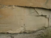
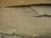
Unfortunately, they can be all but impossible to see unless the light is just right. Compare this diagram of the Battle Scene

Image

...with these palimpsests on the rock face:

Image

Image

(Click on the thumbnails. You may need to click on each image to view the full-size file. My apologies if you get any objectionable, NSFW popups. The feature on the new Photobucket beta that is supposed to allow downloading of original files is not currently working.)

Writing-on-Stone Provincial Park
jkE1Z4YDLd0
Be not too curious of Good and Evil;
Seek not to count the future waves of Time;
But be ye satisfied that you have light
Enough to take your step and find your foothold.

--T.S. Eliot
User avatar
Antipatros
Posts: 644
Joined: Thu Jan 19, 2012 7:33 pm

Head-Smashed-In Buffalo Jump

Post by Antipatros »

Buffalo jumps are not rare in this part of the world: there are seven within Fish Creek Provincial Park alone. But this one is something out of the ordinary.

Head Smashed In Buffalo Jump, World Heritage Site, Canada
bqhdzylZxjs

Head-Smashed-In Buffalo Jump - Alberta, Canada
ZHB4jhmXSFg

Buffalo Tracks

Educational and Scientific Studies from Head-Smashed-In Buffalo Jump

http://history.alberta.ca/headsmashedin ... tracks.pdf
Head-Smashed-In Buffalo Jump, located in the Porcupine Hills of Southern Alberta, 18 km north and west of Fort Macleod, is one of the oldest, largest and best preserved buffalo jump sites in North America. Head-Smashed-In was designated a World Heritage Site in 1981. In doing so, the members of UNESCO recognized the outstanding intrinsic value in protecting and preserving this historic site for present and future generations....

What makes Head-Smashed-In unique as a World Heritage Site?

Machu Picchu in Peru, the Taj Mahal in India, the Palace of Versailles in France and the Pyramid fields of Egypt are but a few of the outstanding cultural properties designated World Heritage Sites. Head-Smashed-In Buffalo Jump joined this exclusive fraternity of World Heritage Sites in 1981. For many visitors it may be unclear why Head-Smashed-In is ranked as a unique cultural place on an equal footing with the pyramids or the Taj Mahal. To the members of the World Heritage Committee, it was clear that Head-Smashed-In Buffalo Jump satisfied the exacting criteria a cultural property must meet to be considered a World Heritage Site.

What did the committee see?

Let us look again at the criteria for an outstanding cultural property and discuss how Head-Smashed-In is unique.

Head-Smashed-In is a very large site, covering 1,470 acres. It contains a wide variety of cultural remains associated with communal buffalo hunting, ranging from drive lane cairns and projectile points to butchered bone and fire-broken rock. These cultural remains, stratified to a depth of 10 meters in some areas of the site, have remained largely undisturbed --one of the only sites of this nature to remain virtually intact. The cultural chronology represented by these undisturbed remains, not to mention their excellent degree of preservation, has provided scientists with a unique opportunity to trace the evolution of communal bison jumping from its earliest beginnings to its eventual abandonment in the 19th century.

Head-Smashed-In was first used for killing bison at least 5,700 years ago and perhaps as early as 10,000 years ago. Except for one major interval, the site was used regularly for hunting buffalo up to the historic period. Its repeated use as a killing site over such a lengthy period of time is a testament to both the ideal conditions of the site for buffalo jumping and the daring and skill of the hunters who used it.

The hunters who first used Head-Smashed-In possessed only rudimentary tools. Their weapons consisted of spears and atlatls (spear-throwers) used with detachable wooden darts tipped with projectile points made of stone. The conventional method of stalking large animals with such simple weapons was dangerous and did not yield sufficient game to feed large groups.

Over time, these early people learned to exploit both the natural topography of the region and their knowledge of bison behavior to hunt them efficiently, despite their lack of sophisticated weapons. Early hunters saw, in the location and topography of Head-Smashed-In, an ideal site for killing bison. The 18 metre cliff facing east, opposite the prevailing winds, prevented bison from smelling the kill site. A large basin of grassland west of the cliff regularly attracted large herds of bison. Over a period of days they could be lured towards the precipice to their deaths. The large stretch of prairie immediately below the cliff provided a source of fresh water and shelter for camping, butchering and processing activities.

The massive bone deposits (over 10 metres deep) testify to the success of generations of hunters in killing buffalo at this site. The deeply stratified deposits preserve not only the record of hundreds of kills but also the evolution of tools and techniques used in the hunt. The stone tools identify discrete prehistoric periods, and the bones and fire-broken rock reflect distinctive butchering and processing techniques.

The use of buffalo jumps for killing bison represented a significant advance in Plains Indian subsistence. To conduct a hunt and process the kill required small bands of people to unite and organize themselves in ways that would benefit the larger group. This led to a more formalized social organization which would characterize the Plains Indian way of life. The success of these buffalo hunts not only brought groups together but enabled larger groups to remain together, and encouraged the development of distinctive cultural identities. The buffalo, whose carcasses yielded most of the necessities of life for the Plains Indian, assumed sacred status to early people and became a focal point around which the bulk of religious and cultural activities revolved. The abundant supply of buffalo afforded the Plains Indian the time and opportunity to develop a rich spiritual and cultural life. In short, communal buffalo hunting was the catalyst for the development and growth of Plains Indian culture as we know it.

The extraordinary archaeological, historical and ethnological value of this site, combined with its dramatic prairie setting and outstanding interpretive potential, were major factors in the designation of Head-Smashed-In Buffalo Jump as a UNESCO World Heritage Site....
Did you know?

http://history.alberta.ca/headsmashedin ... uknow.aspx
When stampeding, a buffalo can reach and sustain speeds of 50 km/hr.

It is estimated that 60 million buffalo roamed the Great Plains at the time of the arrival of Europeans in North America.

During the summer months the buffalo hair is at its shortest. Skins were taken for lodge covers and numerous other articles were made from the soft, dressed skins.

Natural topographic barriers such as coulees, depressions, or hills were sometimes used to funnel buffalo to the jump. Such is the case at Head–Smashed–In.

Buffalo herds were led by one or two individual animals, usually females.

Some meat was made into pemmican by first sun–drying it, then pulverizing the dried meat with a stone maul and mixing this with buffalo fat and grease. To add flavor to pemmican, fruit such as chokecherries were then mixed together in a parfleche container and pounded to remove all air from the food. This pounded mixture, when carefully prepared, would keep in a tight parfleche container for many months.

Buffalo horns were scraped and formed into spoons.

Buffalo tongues were often given to medicine men or women, who were responsible for ensuring the success of the hunt.

Peter Fidler was probably the first European explorer to visit the Porcupine Hills area. He traveled there in 1792/93 with a band of Peigans.
Jack W. Brink, Imagining Head-Smashed-In (2008)

Aboriginal Buffalo Hunting on the Northern Plains

http://www.aupress.ca/books/120137/eboo ... hed_In.pdf (free; entire volume)
http://www.aupress.ca/index.php/books/120137 (free; chapter-by-chapter)
Foreword

Archaeology on the northern plains spans the second half of the twentieth century. Although people had found objects from the old stone age, the dedicated inquiry that goes with the profession only appeared when universities and museums supported researchers. These curators and professors, such as Richard Forbis (1919–1999) and Marie Wormington (1914–1994), made their occupation the full time search for traces of ancient people. That first generation brought with them the methods of an observational science. Their immediate goal was to systematically excavate through the different strata and record their findings. Their long-term objective was to make sense of the artifacts and features in order to understand the cultural history of the northern plains. Their motivation was to establish a chronology or devise a taxonomy from patterns in the material culture they unearthed. More importantly, they trained the students who would pick up the task of interpreting the artchaeological record and find the interpretations that fit the data.

From then to the present generation, the sites that persistently pique the imagination are the enigmatic buffalo jumps. Interpreting the archaeological record may seem like trying to find answers in the entrails of a badger. However, archaeologists possess many methods that help them understand the life and culture of people who in ancient times called the northern plains their home. The modern era in archaeology benefits from breakthroughs in other disciplines, but in return archaeologists contribute food for thought. Like many in this profession, Jack Brink feels fortunate that he can conduct research that continuously stokes the sense of wonder that makes his job worthwhile. He also recognizes that there exists strong public interest in archaeological work and that we have a duty to report the results of our inquiries in an accessible manner. Thus he can inject his wry sense of humour into the text to illustrate a point he wants to make.

When Jack began his studies in archaeology he was able to concentrate on that topic at university. As a young student he learned his trade from his elder academics, but he was not content to merely absorb data. He has devoted his career to expanding the knowledge base he inherited from them. Of course the challenge for him was not just to look for answers, but also to look for questions. What remains to be done in northern plains archaeology? What questions will preoccupy the current generation of archaeologists? You might well ask. Jack certainly has. He has picked up the task initiated by his intellectual predecessors and continues to look for insights amid the buffalo jumps. The reader will easily find the humanity in both the author and his subject. Nowhere is there a hint of the stereotypical researcher preoccupied with minutiae while ignoring the big picture around him.

Curiosity and wonder drew Jack to the cliffs and crevices that fired his imagination. This memoir of his contemplations about the buffalo jumps, and other artifacts of ancient people, is a synthesis of his life’s work. Together with his knowledge he takes on the role of storyteller, relating the personal anecdotes that spiced up his research. He also poses challenges for the next generation. What research questions will they formulate to imagine the northern plains in ancient times? How will they use the knowledge they gain? Well, that is up to them to determine, but at least they will have Jack Brink’s narrative to guide their thoughts.

The vantage point from his perspective is similar to the expansive view of the plains from the edge of the precipice. His endeavours have culminated with this inspired volume. From his pen flows a quixotic tour through archaeology; with his own practical guide for imagining northern plains antiquity, including all the blood and guts. More than anything, Jack shows us yet again that buffalo do not jump; they have to be pushed!

Eldon Yellowhorn
Assistant Professor
Department of Archaeology/First Nations Studies
Simon Fraser University
Burnaby, British Columbia
EDIT:

Imagining Head-Smashed-In

by AU Press

http://www.youtube.com/playlist?list=PL9046FD4FDB1FA786

32 videos in all.
Last edited by Antipatros on Thu Oct 18, 2012 7:01 pm, edited 1 time in total.
Be not too curious of Good and Evil;
Seek not to count the future waves of Time;
But be ye satisfied that you have light
Enough to take your step and find your foothold.

--T.S. Eliot
User avatar
Marcus
Posts: 2409
Joined: Tue Dec 27, 2011 2:23 pm
Location: Alaska

Re: Archaeology, Re-enactment & Reconstruction

Post by Marcus »

Antipatros wrote:. . Ned Kelly, one of Australia’s most celebrated, reviled, and polarizing historical figures . .
2LH7FXf66KU
"The jawbone of an ass is just as dangerous a weapon today as in Sampson's time."
--- Richard Nixon
******************
"I consider looseness with words no less of a defect than looseness of the bowels."
—John Calvin
User avatar
Antipatros
Posts: 644
Joined: Thu Jan 19, 2012 7:33 pm

Angkor 1

Post by Antipatros »

Angkor
KKEW_etByJo

Angkor

http://whc.unesco.org/en/list/668/
Brief Description

Angkor is one of the most important archaeological sites in South-East Asia. Stretching over some 400 km2, including forested area, Angkor Archaeological Park contains the magnificent remains of the different capitals of the Khmer Empire, from the 9th to the 15th century. They include the famous Temple of Angkor Wat and, at Angkor Thom, the Bayon Temple with its countless sculptural decorations. UNESCO has set up a wide-ranging programme to safeguard this symbolic site and its surroundings.

Outstanding Universal Value

Brief synthesis

Angkor, in Cambodia’s northern province of Siem Reap, is one of the most important archaeological sites of Southeast Asia. It extends over approximately 400 square kilometres and consists of scores of temples, hydraulic structures (basins, dykes, reservoirs, canals) as well as communication routes. For several centuries Angkor, was the centre of the Khmer Kingdom. With impressive monuments, several different ancient urban plans and large water reservoirs, the site is a unique concentration of features testifying to an exceptional civilization. Temples such as Angkor Wat, the Bayon, Preah Khan and Ta Prohm, exemplars of Khmer architecture, are closely linked to their geographical context as well as being imbued with symbolic significance. The architecture and layout of the successive capitals bear witness to a high level of social order and ranking within the Khmer Empire. Angkor is therefore a major site exemplifying cultural, religious and symbolic values, as well as containing high architectural, archaeological and artistic significance.

The park is inhabited, and many villages, some of whom the ancestors are dating back to the Angkor period are scattered throughout the park. The population practices agriculture and more specifically rice cultivation.

Criterion (i): The Angkor complex represents the entire range of Khmer art from the 9th to the 14th centuries, and includes a number of indisputable artistic masterpieces (e.g. Angkor Wat, the Bayon, Banteay Srei).

Criterion (ii): The influence of Khmer art as developed at Angkor was a profound one over much of South-east Asia and played a fundamental role in its distinctive evolution.

Criterion (iii): The Khmer Empire of the 9th-14th centuries encompassed much of South-east Asia and played a formative role in the political and cultural development of the region. All that remains of that civilization is its rich heritage of cult structures in brick and stone.

Criterion (iv): Khmer architecture evolved largely from that of the Indian sub-continent, from which it soon became clearly distinct as it developed its own special characteristics, some independently evolved and others acquired from neighboring cultural traditions. The result was a new artistic horizon in oriental art and architecture.

Integrity

The Angkor complex encompasses all major architectural buildings and hydrological engineering systems from the Khmer period and most of these “barays” and canals still exist today.

All the individual aspects illustrate the intactness of the site very much reflecting the splendor of the cities that once were.

The site integrity however, is put under dual pressures:

a) endogenous: exerted by more than 100,000 inhabitants distributed over 112 historic settlements scattered over the site, who constantly try to expand their dwelling areas;

b) exogenous: related to the proximity of the town of Siem Reap, the seat of the province and a tourism hub.

Authenticity

Previous conservation and restoration works at Angkor between 1907 and 1992, especially by the École Française d’Extrême-Orient (EFEO), the Archaeological Survey of India, the Polish conservation body PKZ, and the World Monuments Fund have had no significant impact on the overall authenticity of the monuments that make up the Angkor complex and do not obtrude upon the overall impression gained from individual monuments....
Here's a useful guide with entries for individual monuments:

Angkor Site Index

http://www.art-and-archaeology.com/seas ... rsite.html

Archaeology of a City: Angkor Thom

http://www.efeo.fr/base.php?code=548
Head of programme: Jacques Gaucher

The first phase of this urban archaeology programme, which has now been completed, was devoted to a complete reconnaissance of the full extent and archaeological depth of the Angkorian capital. The cross referencing and cartographic analysis of surface elements and soil sediment in a 9,000,000 m² covered by forest provided confirmation of the urban character of the site, and data for the preparation of an archaeological city plan which will shortly be published. As a summary of current knowledge, it will provide the basis for archaeological reasoning on the level of city, considered as an indivisible entity, and play a key role in a second phase of research focusing on major changes in the urban development of Angkor Thom. Since 2008, excavations accompanied by related studies - in particular of recovered ceramics which are the subject of a training programme - have focused on structural elements of the capital (elements defining its perimeter, the royal palace, the citadel, and various networks etc.). Analysis of their monumental character will enable us to highlight the form, functioning and time period of a certain number of major processes of succession which marked the Khmer capital from its earliest days until it was abandoned.
Be not too curious of Good and Evil;
Seek not to count the future waves of Time;
But be ye satisfied that you have light
Enough to take your step and find your foothold.

--T.S. Eliot
User avatar
Antipatros
Posts: 644
Joined: Thu Jan 19, 2012 7:33 pm

Angkor 2

Post by Antipatros »

Image

Radar Image with Color as Height, Sman Teng, Temple, Cambodia

NASA/JPL

http://archive.org/details/PLAN-PIA03866
This image of Cambodia's Angkor region, taken by NASA's Airborne Synthetic Aperture Radar (AIRSAR), reveals a temple (upper-right) not depicted on early 19th Century French archeological survey maps and American topographic maps. The temple, known as "Sman Teng," was known to the local Khmer people, but had remained unknown to historians due to the remoteness of its location. The temple is thought to date to the 11th Century: the heyday of Angkor. It is an important indicator of the strategic and natural resource contributions of the area northwest of the capitol, to the urban center of Angkor. Sman Teng, the name designating one of the many types of rice enjoyed by the Khmer, was "discovered" by a scientist at NASA's Jet Propulsion Laboratory, Pasadena, Calif., working in collaboration with an archaeological expert on the Angkor region. Analysis of this remote area was a true collaboration of archaeology and technology. Locating the temple of Sman Teng required the skills of scientists trained to spot the types of topographic anomalies that only radar can reveal. This image, with a pixel spacing of 5 meters (16.4 feet), depicts an area of approximately 5 by 4.7 kilometers (3.1 by 2.9 miles). North is at top. Image brightness is from the P-band (68 centimeters, or 26.8 inches) wavelength radar backscatter, a measure of how much energy the surface reflects back toward the radar. Color is used to represent elevation contours. One cycle of color represents 25 meters (82 feet) of elevation change, so going from blue to red to yellow to green and back to blue again corresponds to 25 meters (82 feet) of elevation change. AIRSAR flies aboard a NASA DC-8 based at NASA's Dryden Flight Research Center, Edwards, Calif. In the TOPSAR mode, AIRSAR collects radar interferometry data from two spatially separated antennas (2.6 meters, or 8.5 feet). Information from the two antennas is used to form radar backscatter imagery and to generate highly accurate elevation data. Built, operated and managed by JPL, AIRSAR is part of NASA's Earth Science Enterprise program. JPL is a division of the California Institute of Technology in Pasadena.
Traci Watson, ScienceShot: Building Angkor Wat

http://news.sciencemag.org/sciencenow/2 ... tml?ref=hp
12 October 2012

Scientists have long known that the sandstone blocks used to build the famous Angkor Wat temple and other monuments in the ancient Cambodian city of Angkor came from quarries at the foot of a sacred mountain nearby. But how did the 5 million to 10 million blocks, some weighing more than 1500 kilograms, reach Angkor? Researchers report in a paper in press at the Journal of Archaeological Science that when they examined Google Earth maps of the area, they saw lines that looked like a transportation network. Field surveys revealed that the lines are a series of canals, connected by short stretches of road and river, that lead from the quarries straight to Angkor. The roads and canals—some of which still hold water—would've carried blocks from the 9th century to the 13th century on a total journey of 37 kilometers or so. The researchers don't know whether the blocks would've floated down the canals on rafts or via some other method. Scholars had previously assumed that the blocks were floated down a canal to the Tonle Sap Lake and then upstream on the Siem Reap River, a route of 90 kilometers. The newly reported canal network would've taken many months and thousands of laborers to construct, but it would have been all in a day's work for Khmer engineers, whose elaborate reservoirs and other hydraulic works at Angkor still inspire awe.
From the University of Pennsylvania Museum of Archaeology and Anthropology (Penn Museum):

Watson Kintner, 1957 #23 Laos/Cambodia (16:36)
http://archive.org/details/upenn-f16-01 ... s-Cambodia

Watson Kintner, 1957 #24 Cambodia (17:22)
http://archive.org/details/upenn-f16-0128_1957_24
Be not too curious of Good and Evil;
Seek not to count the future waves of Time;
But be ye satisfied that you have light
Enough to take your step and find your foothold.

--T.S. Eliot
User avatar
Antipatros
Posts: 644
Joined: Thu Jan 19, 2012 7:33 pm

Re: Archaeology, Re-enactment & Reconstruction

Post by Antipatros »

Matthew Brunwasser, Zeugma After the Flood

New excavations continue to tell the story of an ancient city at the crossroads between east and west

http://www.archaeology.org/1211/feature ... saics.html
It wasn't good policy that saved ancient Zeugma. It was a good story. In 2000, the construction of the massive Birecik Dam on the Euphrates River, less than a mile from the site, began to flood the entire area in southern Turkey. Immediately, a ticking time-bomb narrative of the waters, which were rising an average of four inches per day for six months, brought Zeugma and its plight global fame. The water, which soon would engulf the archaeological remains, also brought increasing urgency to salvage efforts and emergency excavations that had already been taking place at the site, located about 500 miles from Istanbul, for almost a year. The media attention Zeugma received attracted generous aid from both private and government sources. Of particular concern was the removal of Zeugma's mosaics, some of the most extraordinary examples to survive from the ancient world. Soon the world's top restorers arrived from Italy to rescue them from the floodwaters. The focus on Zeugma also brought great numbers of international tourists—and even more money—a trend that continues today with the opening in September 2011 of the ultramodern $30 million Zeugma Mosaic Museum in the nearby city of Gaziantep.

But Zeugma's story begins millennia before the dam was constructed. In the third century B.C., Seleucus I Nicator ("the Victor"), one of Alexander the Great's commanders, established a settlement he called Seleucia, probably a katoikia, or military colony, on the western side of the river. On its eastern bank, he founded another town he called Apamea after his Persian-born wife. The two cities were physically connected by a pontoon bridge, but it is not known whether they were administered by separate municipal governments, and nothing of ancient Apamea, nor the bridge, survives. In 64 B.C., the Romans conquered Seleucia, renaming the town Zeugma, which means "bridge" or "crossing" in ancient Greek. After the collapse of the Seleucid Empire, the Romans added Zeugma to the lands of Antiochus I Theos of Commagene as a reward for his support of General Pompey during the conquest.

Throughout the imperial period, two Roman legions were based at Zeugma, increasing its strategic value and adding to its cosmopolitan culture. Due to the high volume of road traffic and its geographic position, Zeugma became a collection point for road tolls. Political and trade routes converged here and the city was the last stop in the Greco-Roman world before crossing over to the Persian Empire. For hundreds of years Zeugma prospered as a major commercial city as well as a military and religious center, eventually reaching its peak population of about 20,000-30,000 inhabitants. During the imperial period, Zeugma became the empire's largest, and most strategically and economically important, eastern border city.

However, the good times in Zeugma declined along with the fortunes of the Roman Empire. After the Sassanids from Persia attacked the city in A.D. 253, its luxurious villas were reduced to ruins and used as shelters for animals. The city's new inhabitants were mainly rural people who employed only simple building materials that did not survive. Zeugma's grandeur and importance would remain forgotten for more than 1,700 years.

This may sound difficult to believe, considering that at least 25 percent of the western bank of the ancient town now sits below almost 200 feet of water and the city's eastern bank is completely submerged, but there is still much left to see—and to excavate—in Zeugma. With the imminent threat of the rising water having abated, archaeologists including Kutalmis Gorkay of Ankara University, who has directed work at Zeugma since 2005, have focused their attention on new projects as well as on conservation and preservation of what remains above the water. Fortunately, these excavations are still relatively well funded, Gorkay says, although the budget is not comparable with the monies that came in during the salvage excavation....
Be not too curious of Good and Evil;
Seek not to count the future waves of Time;
But be ye satisfied that you have light
Enough to take your step and find your foothold.

--T.S. Eliot
User avatar
Antipatros
Posts: 644
Joined: Thu Jan 19, 2012 7:33 pm

Re: Archaeology, Re-enactment & Reconstruction

Post by Antipatros »

Further to the successes of AIRSAR and Google Earth at Angkor, an archaeologist discusses Google Earth as a tool for finding Roman sites, particularly in Saudia Arabia:

David Kennedy: Ancient Ruins
7hakGJU9xco
Be not too curious of Good and Evil;
Seek not to count the future waves of Time;
But be ye satisfied that you have light
Enough to take your step and find your foothold.

--T.S. Eliot
User avatar
Antipatros
Posts: 644
Joined: Thu Jan 19, 2012 7:33 pm

Angkor 3

Post by Antipatros »

Image

Angkor, Cambodia (11/13/1996) NASA

http://archive.org/details/PLAN-PIA00505
This is an image of the area around the city of Angkor, Cambodia. The city houses an ancient complex of more than 60 temples dating back to the 9th century. The principal complex, Angkor Wat, is the bright square just left of the center of the image. It is surrounded by a reservoir that appears in this image as a thick black line. The larger bright square above Angkor Wat is another temple complex called Angkor Thom. Archeologists studying this image believe the blue-purple area slightly north of Angkor Thom may be previously undiscovered structures. In the lower right is a bright rectangle surrounded by a dark reservoir, which houses the temple complex Chau Srei Vibol. In its heyday, Angkor had a population of 1 million residents and was the spiritual center for the Khmer people until it was abandoned in the 15th century. The image was acquired by the Spaceborne Imaging Radar-C/X-band Synthetic Aperture Radar (SIR-C/X-SAR) on the 15th orbit of the space shuttle Endeavour on September 30, 1994. The image shows an area approximately 55 kilometers by 85 kilometers (34 miles by 53 miles) that is centered at 13.43 degrees north latitude and 103.9 degrees east longitude. The colors in this image were obtained using the following radar channels: red represents the L-band (horizontally transmitted and received); green represents the L-band (horizontally transmitted and vertically received); blue represents the C-band (horizontally transmitted and vertically received). The body of water in the south-southwest corner is Tonle Sap, Cambodia's great central lake. The urban area at the lower left of the image is the present-day town of Siem Reap. The adjoining lines are both modern and ancient roads and the remains of Angkor's vast canal system that was used for both irrigation and transportation. The large black rectangles are ancient reservoirs. Today the Angkor complex is hidden beneath a dense rainforest canopy, making it difficult for researchers on the ground to study the ancient city. The SIR-C/X-SAR data are being used by archaeologists at the World Monuments Fund and the Royal Angkor Foundation to understand how the city grew, flourished and later fell into disuse over an 800-year period. The data are also being used to help reconstruct the vast system of hydrological works, canals and reservoirs, which have gone out of use over time. Research teams from more than 11 countries will be using this data to study the Angkor complex. Spaceborne Imaging Radar-C and X-Synthetic Aperture Radar (SIR-C/X-SAR) is part of NASA's Mission to Planet Earth. The radars illuminate Earth with microwaves allowing detailed observations at any time, regardless of weather or sunlight conditions. SIR-C/X-SAR uses three microwave wavelengths: L-band (24 cm), C-band (6 cm) and X-band (3 cm). The multi-frequency data will be used by the international scientific community to better understand the global environment and how it is changing. The SIR-C/X-SAR data, complemented by aircraft and ground studies, will give scientists clearer insights into those environmental changes which are caused by nature and those changes which are induced by human activity. SIR-C was developed by NASA's Jet Propulsion Laboratory. X-SAR was developed by the Dornier and Alenia Spazio companies for the German space agency, Deutsche Agentur fuer Raumfahrtangelegenheiten (DARA), and the Italian space agency, Agenzia Spaziale Italiana (ASI).
Image

Angkor Wat: Image of the Day (April 12, 2004) NASA

http://archive.org/details/angkor_wat_IKO_2004103
Tucked deep in the Cambodian rainforest, the ancient Angkor Wat temple is considered one of the most valuable architectural sites in Asia. Angkor Wat is the pinnacle of the city of Angkor, capital of the once-powerful Khmer Empire of Southeast Asia. The temple was built by Suryavarman II between 1113 and 1150 AD. Dedicated to the Hindu god Vishnu, Angkor Wat is a representation of Mount Meru, home of the gods and the center of the Hindu universe. In addition to its unique pyramid temple architecture, Angkor Wat is covered with intricate bas-relief carvings of Hindu epics. Many of the symbolic architectural features are clearly visible in this Ikonos image, acquired on April 12, 2004. The temple complex is surrounded by a 174-meter- (570-foot-) wide moat, visible in the large image, that represents the oceans at the edge of the universe. A stone causeway leads through the Hindu universe to the temple home of the gods from the west, on the left side of the image. The temple complex itself is a series of buildings on rising terraces like the slopes of a mountain. At the center of Angkor Wat are five towers that represent the five peaks of Mount Meru. The round towers mark out the corners and the center of the innermost square of the complex. Like the mountain peaks they represent, the towers are pointed on top. The pinnacle of each tower is slightly lighter than the surrounding black stone in this image.
Image

Angkor Ruins: Image of the Day (February 17, 2004) NASA

NASA image created by Jesse Allen, Earth Observatory, using data provided courstesy of NASA/GSFC/METI/ERSDAC/JAROS, and the U.S./Japan ASTER Science Team

http://archive.org/details/aster_angorwat_17feb04
The ancient city of Angkor sat at the center of the once powerful Khmer Empire of Southeast Asia. Located north of Tonle Sap Lake in Cambodia, the capital city flourished between the 9th and 15th centuries. The royal family abandoned the city in the 15th century, and the city was swallowed by the surrounding jungle, though never entirely abandoned. Now a World Heritage Site, the ruins of the ancient city cover some 400 square kilometers. Angkor has been called one of the most important archeological sites in Southeast Asia by the United Nations Educational, Scientific and Cultural Organization (UNESCO), and the vestige of its prosperity can be found in the Angkor ruins. Perhaps the most famous site in Angkor is Angkor Wat, a vast temple complex built by Suryayarman II in the early 12th century to honor the Hindu god Vishnu. The temple complex is clearly visible in the above image as the small black frame just below the image center. The frame is created by a 190-meter wide causeway, which encircles three galleries and five central shrines that tower up to 65 meters. The entire complex occupies an area of 1.5 x 1.3 kilometers. To the north of Angkor Wat is the larger square of Angkor Thom, the inner royal city built in the 12th century. The now dry moat around Angkor Thom is still visible as a pale pink square cut through the surrounding green vegetation. Within the square is a palace, homes for priests and government officials, and government administration buildings. West of Angkor Thom is the vast Western Baray, a reservoir built in the 11th century. The earthen walls constructed to hold water form a perfect rectangle, oriented exactly east-west. It is thought that the Western Baray and its predecessor, the Eastern Baray, were built to provide water to the city, control water levels on the Siem Reap River, and provide irrigation water to the surrounding plain. Though filled with silt today, the smaller Eastern Baray is also visible in this image. Its earthen walls form a 1.8 by 7.5 kilometer rectangle east of Angkor Thom. Constructed in the 9th Century, the Eastern Baray was probably about 3 meters deep and held an estimated 37.2 million cubic meters of water. The simulated natural color image was acquired on February 17, 2004, by the Advanced Spaceborne Thermal Emission and Reflection Radiometer ( asterweb.jpl.nasa.gov/ ASTER ) on NASA's terra.nasa.gov/ Terra satellite. It is centered near 13.4 degrees North latitude, 103.9 degrees East longitude, and covers an area of 22.4 x 29.9 km. In this image, water is black and blue, vegetation is bright green, and bare earth is pink.
Be not too curious of Good and Evil;
Seek not to count the future waves of Time;
But be ye satisfied that you have light
Enough to take your step and find your foothold.

--T.S. Eliot
User avatar
Antipatros
Posts: 644
Joined: Thu Jan 19, 2012 7:33 pm

Angkor 4

Post by Antipatros »

H.G. Quaritch Wales, Towards Angkor (1937)

In the footsteps of the Indian invaders

http://archive.org/details/towardsangkor035302mbp
Across the steaming lowlands of eastern Central Siam a train of heavily laden bullock-carts was laboriously wending its way. The country it 'was traversing was not the luxuriant evergreen forest which clothes so much of Indo-China, for there cart travel is impossible; this was the shadeless, thin jungle of poor deciduous trees and tall grass, the haunt of tiger and deer, and though in the dry season it allows the use of carts instead of porters or elephants, it is by far the more trying to the traveller.

This particular caravan, with its screeching wooden axles and jingling bells the true music of the jungle track differed little from those one might see on any of the well-beaten trade routes which still form for many towns and villages in the remoter parts of Siam their only link with the railway and the capital. But for this route, which ran eastward from Lopburi towards the little-known Pasak valley, the remarkable thing about the caravan was its size: no less than eight carts, not to mention several armed men mounted on ponies. For the fact is that in A.D. 1936 this was really no trade route at all, and two or three men with pack-ponies or with a couple of carts were all that one might expect to find peddling cheap wares to the few squalid villages of this poor and undeveloped part of the country even at the very height of the dry season. But had it been just fifteen hundred years earlier, A.D. 436 (and unless one draws close enough to inspect the personnel in detail there is nothing to suggest that it might not be), it would have been a common experience to pass within an hour a dozen of such caravans of merchants, bearing eastward the products of the rich lands of the Menam valley to exchange them for goods from India at the great emporium of Sri Deva. This was the name of the city that guarded the pass at the point where the route left the plateau of the kingdom of Fu-nan and made its way to the lowland vassal states of the west. But on looking closer one sees that the bullock-drivers are Siamese peasants, that two Europeans clad in dusty shirts and shorts the author and his wife are tramping in the rear, and that what looks at first sight like any other caravan is in fact a scientific expedition on its way to probe one of the most enthralling mysteries of the ancient East, of which at that time the unrevealing heart of Indo-China still held the solution. The "mystery" was no less than that of the origin of Angkor and the Khmer civilization....

In those great legendary stories the Ramayana and the Mahabharata India has epics worthy of comparison with the Iliad of Homer, though to some extent they fail in their appeal to the Western mind by reason of the preponderance of the miraculous. To those, therefore, who hold historic truth to be a weighty consideration, and delight rather in the courageous deeds of flesh-and-blood heroes, the noblest Indian epic must surely be the story of those Argonauts and colonists who, braving the blackest dangers, carried the culture of India across the eastern seas. Paradoxically enough, the stirring events of those heroic times passed unremembercd among a people whose historical sense as yet lay dormant, and it has remained for modern scholarship to attempt the reconstruction of the tale which I have endeavoured to outline.

As scholars, both European and Indian, continue to devote thought to the problems that still await solution, as the swamps and forests of Indo-China gradually yield their secrets to the archaeological explorer, so may we hope to fill in the details on our broad canvas, and paint in all its vivid imagery the deeds of the Indian pioneers whose fearless exploits and immortal achievements make one of the most glorious chapters in the history of mankind. As Dr Rabindranath Tagore, in his foreword to the first issue of The Greater India Society's Journal, has expressed it in his own inimitable style:
To know my country in truth one has to travel to that age when she realized her soul, and thus transcended her physical boundaries; when she revealed her being in a radiant magnanimity which illumined the eastern horizon, making her recognized as their own by those in alien shores who were awakened into a great surprise of life; and not now when she has withdrawn herself within a narrow barrier of obscurity, into a miserly pride of exclusiveness, into a poverty of mind that dumbly revolves round itself in an unmeaning repetition of a past that has lost its light and has no message to the pilgrims of the future.
In the finest art of Java and Champa India certainly realized her soul; but it would seem to be a law of nature that the consummation of perfection requires the aid of a fitting mate. In Greater India it is in Cambodia that we find that ideal union of Indian inspiration with a native genius, symbolized so poetically by the meeting of Prince Kaundinya with Queen Willow-leaf, which gave birth to Indo-Khmer culture, and produced as its outward manifestation one of the great arts of all times, culminating in the wonder that is Angkor.
Be not too curious of Good and Evil;
Seek not to count the future waves of Time;
But be ye satisfied that you have light
Enough to take your step and find your foothold.

--T.S. Eliot
User avatar
Antipatros
Posts: 644
Joined: Thu Jan 19, 2012 7:33 pm

Re: Archaeology, Re-enactment & Reconstruction

Post by Antipatros »

PBS Nova and National Geographic, Ghosts of Machu Picchu
PHaThSz4ihM
Be not too curious of Good and Evil;
Seek not to count the future waves of Time;
But be ye satisfied that you have light
Enough to take your step and find your foothold.

--T.S. Eliot
User avatar
Antipatros
Posts: 644
Joined: Thu Jan 19, 2012 7:33 pm

Re: Archaeology, Re-enactment & Reconstruction

Post by Antipatros »

Via Archaeology.org:

Buried with a stake through a heart: the medieval 'vampire' burial

New details of one of the few 'vampire' burials reserved for social 'deviants' in early medieval Britain have emerged.

http://www.telegraph.co.uk/history/9647 ... urial.html
The discovery of a skeleton found with metal spikes through its shoulders, heart and ankles, dating from 550-700AD and buried in the ancient minster town of Southwell, Notts, is detailed in a new report.

It is believed to be a 'deviant burial', where people considered the 'dangerous dead', such as vampires, were interred to prevent them rising from their graves to plague the living.

In reality, victims of this treatment were social outcasts who scared others because of their unusual behaviour. Only a handful of such burials have been unearthed in the UK.

The discovery is detailed in a new report by Matthew Beresford, of Southwell Archaeology.

The skeleton was found by archaeologist Charles Daniels during the original investigation of the site in Church Street in the town 1959, which revealed Roman remains.

Mr Beresford said when Mr Daniels found the skeleton one of the first things he did was to check for fangs in a light-hearted way.

"In the 1950s the Hammer Horror films were popular and so people had seen Christopher Lee's Dracula so it would have been quite relevant," said Mr Beresford.

In his report, Mr Beresford says: "The classic portrayal of the dangerous dead (more commonly known today as a vampire) is an undead corpse arising from the grave and all the accounts from this period reflect this.

"Throughout the Anglo-Saxon period the punishment of being buried in water-logged ground, face down, decapitated, staked or otherwise was reserved for thieves, murderers or traitors or later for those deviants who did not conform to societies rules: adulterers, disrupters of the peace, the unpious or oath breaker.

"Which of these the Southwell deviant was we will never know."

Mr Beresford believes the remains may still be buried on the site where they originally lay because Mr Daniels was unable to remove the body from the ground.

He said: "If you look at it in a spooky way you still have the potential for it to rise at some point."

Mr Beresford added: "Obviously this skeleton comes from a time in Southwell's history that we don't know much about."

John Lock, chairman of Southwell Archaeology, said the body was one of a handful of such burials to be found in the UK.

He said: "A lot of people are interested in it but quite where it takes us I don't know because this was found in the 1950s and now we don't know where the remains are.

Mr Lock said no one could be sure why the body was staked in the way it was.

He said: "People would have a very strong view that this was somebody who, for whatever reason, they had a reason to fear and needed to ensure that this person did not come back."
Matthew Beresford, The Dangerous Dead (2012)

The Early Medieval deviant burial at Southwell, Nottinghamshire in a wider context

http://www.mbarchaeology.co.uk/wp-conte ... 20Dead.pdf
Be not too curious of Good and Evil;
Seek not to count the future waves of Time;
But be ye satisfied that you have light
Enough to take your step and find your foothold.

--T.S. Eliot
User avatar
Antipatros
Posts: 644
Joined: Thu Jan 19, 2012 7:33 pm

Re: Archaeology, Re-enactment & Reconstruction

Post by Antipatros »

Via Archaeology.org:

Nick Collins, Anglo-Saxon hall found in Kent is 'tip of the iceberg'

An Anglo-Saxon feasting hall unearthed beneath a village green in Kent could represent the "tip of the iceberg", according to archaeologists who believe it lies amid an entire complex of ancient buildings.

http://www.telegraph.co.uk/earth/enviro ... eberg.html
The rare 7th to 9th century hall, which would have accommodated up to 60 people during royal feasts, was the first to be discovered in more than 30 years when it was excavated by Reading University experts this summer.

But further developments are expected over the coming years as researchers plan to scour the surrounding area in the hope of finding an entire network of other buildings.

Feasting halls like the one uncovered in Lyminge, which contained jewels, animal bones and a broken horse's harness, were always part of a larger complex of houses built for accommodation and other ceremonial purposes during royal visits, experts explained.

The initial trench in which the hall was first glimpsed also contained the foundations of another building, suggesting the newly discovered site is no exception.

Dr Gabor Thomas, the excavation director, said: "Probably the best excavated complex is a site called Yeavering in Northumbria which produced what seemed to be some kind of grandstand.

"One of the purposes of these sites is for assembly, and it is argued that is precisely what it was for – people would have sat to hear proclamations and laws being passed.

"It could be that we will find something that is highly distinctive in terms of what is found in Anglo-Saxon settlements of this period, the chances are quite high that we will find something we haven't seen before."

The foundations of the feasting hall are "remarkably" well preserved and may be particularly important because they were found in Kent, the most powerful pre-Christian Anglo-Saxon kingdom, he added.

Ruins of a monastery were also found at the same site, suggesting it could contain tantalising clues about the transition from paganism to Christianity.

Dr Thomas said: "We have also got 'what happened next'. We have got the church and the monastic settlement that grew up around it, which have been excavated since 2008. This is one of the only areas where you have got the full transition from pagan to Christian."
Archaeologists reveal rare Anglo-Saxon feasting hall

http://www.reading.ac.uk/news-and-event ... 72531.aspx
A rare Anglo-Saxon feasting hall has been spectacularly uncovered by a team of archaeologists from the University of Reading working at Lyminge in Kent....

This is the first discovery of a previously unknown Anglo-Saxon ‘Great Hall' in over 30 years and one of only a handful of such major buildings to be excavated in its entirety. Large enough to accommodate up to 60 people and forming part of a formal complex of buildings, the hall would have been used as a venue for royal assemblies attended by the king and his armed entourage.

The current excavations, funded by the Arts and Humanities Research Council (AHRC) with support from project partners Kent Archaeological Society and staff from the Canterbury Archaeological Trust, are designed to shed new light on Lyminge as a key site for understanding the origins of Christianity in Anglo-Saxon England.

Previous excavations have shown that extensive remains of a 7th to 9th century Anglo-Saxon monastery lie preserved literally inches beneath open areas of the village; the Great Hall discovered in 2012 represents a royal precursor to the monastery. However a geophysical survey failed to reveal the hall and its discovery was entirely unanticipated.

Dr Gabor Thomas, from the University of Reading's Department of Archaeology said: "This hall is remarkably well preserved. With a ground-plan in excess of 160m square, the hall is comparable in scale and importance to some of the largest Saxon timber halls previously excavated in England at sites such as Yeavering and Cowdery's Down.

"The Hall provides an exceedingly rare glimpse of royal accommodation of a type otherwise evoked in the Anglo-Saxon poem Beowulf. Such structures were manifestly not ‘houses'; they were prestigious buildings used at specific times for a specific purpose such as periodic gatherings involving feasting and gift-giving that reinforced the social bonds between the king and his loyal retainers."

Artefacts recovered from the foundations of the hall provide definitive evidence for high-status activities, most notable being fragments of luxury glass vessels and a rare bridle fitting of a type that has only previously been found in graves belonging to the Anglo-Saxon warrior elite.

Dr Thomas continued: "Nearly all the archaeological information shedding light on Kent around the time of the conversion to Christianity is based upon cemetery finds. The site at Lyminge is the first to provide a detailed picture of life at an aristocratic estate centre in Anglo-Saxon Kent during the height of the kingdom's political power at the end of the 6th century. Further excavations, funded by the Arts and Humanities Research Council, will be carried out next summer and in the summer of 2014. This exciting project looks set to continue transforming our understanding of how Christianity impacted daily life in Anglo-Saxon England."
Photos: https://www.facebook.com/theuniversityo ... tos_stream

Project blog (with great photos): http://blogs.reading.ac.uk/lyminge/
Be not too curious of Good and Evil;
Seek not to count the future waves of Time;
But be ye satisfied that you have light
Enough to take your step and find your foothold.

--T.S. Eliot
Post Reply